Beach · Vlorë
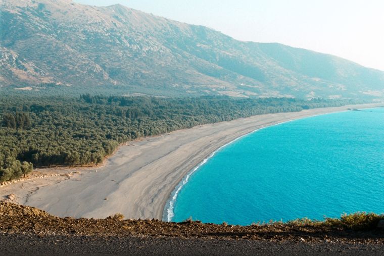
Borsh Beach
At roughly 7 km, the longest single beach on the Riviera, backed by one of Albania's largest olive groves.
Every county, coast and century
Guided view
New to Albania? Every page opens with a plain-language explanation you could read to a ten-year-old, before the detail begins.
Expert view
You already know the basics. Straight to the substance, with the simple explanations hidden. This is the default.
Beach · Vlorë County
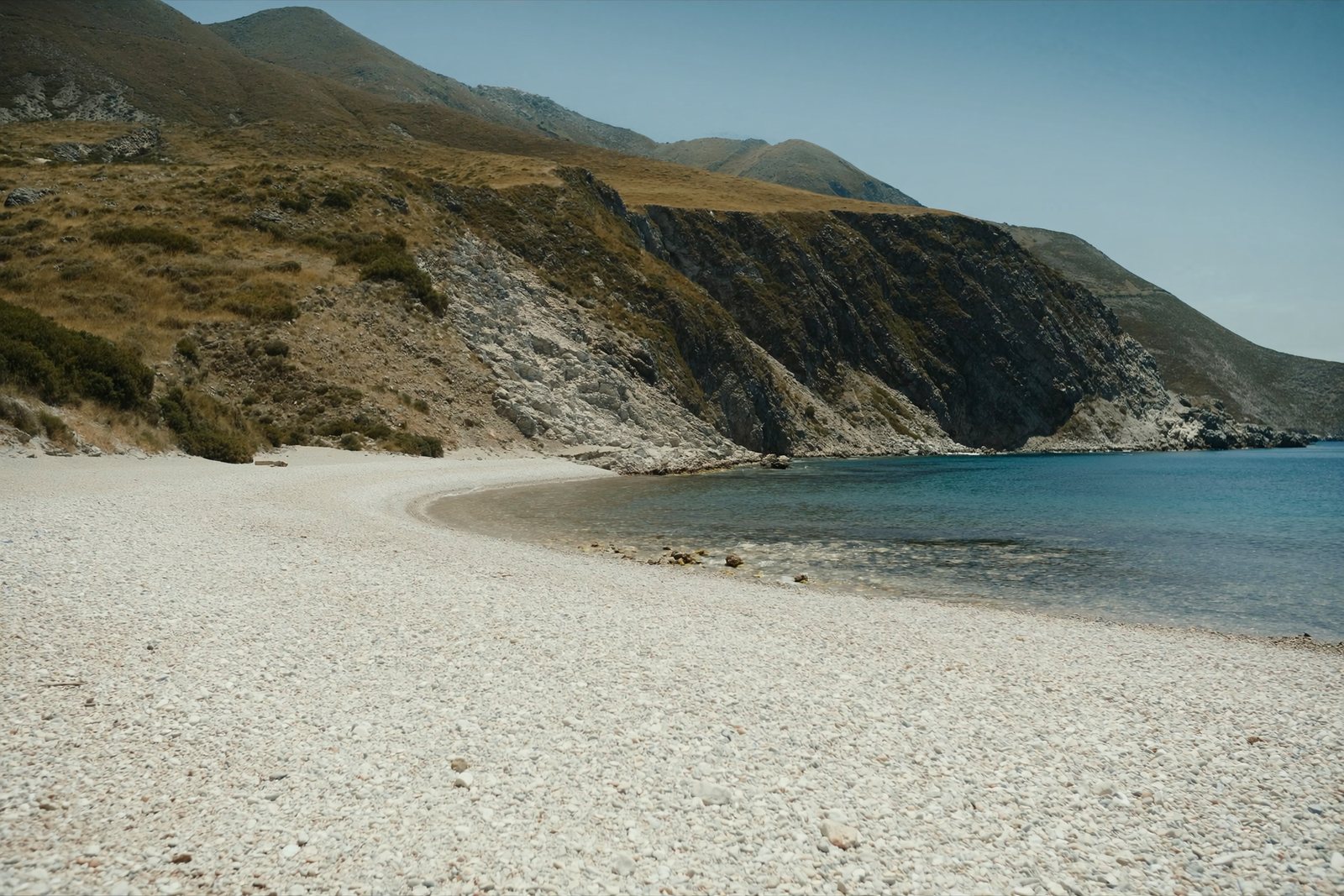
One of the least-developed larger coves on the southern Riviera.
Save
Krorëz is a wide pebble beach south of Borsh that is hard to reach by car, so it stays quiet.
Krorëz is a wide pebble beach south of Borsh that is hard to reach by car, so it stays quiet.
Lukovë is a village in Vlorë County, in southern Albania. It was formerly a municipality in its own right until the 2015 local government reform, at which point it became a subdivision of the municipality of Himarë. The population recorded at the 2011 census was 2,916.
The Albanian toponym Lukovë derives from Slavic roots. Proposed etymologies include the words luk, laka, or luka, meaning water flowing nearby, meadowland, river meadow, or wet meadow along a river, or alternatively from luk or luka meaning a place of onions, combined with the suffix ov/a. The village is known in Greek as Λούκοβο.
During the Ottoman period, Lukovë, together with the nearby settlements of Piqeras and Nivicë, formed part of the Himara area and held special semi-autonomous status within that community. In 1570 and 1571, a short-lived rebellion broke out under Emmanuel Mormoris in the Himara region; after a prolonged siege, the rebels captured the castle of Nivicë.
In 1798, Lukovë and adjacent villages south of Himara were attacked and plundered by Ali Pasha of Ioannina, the local Ottoman lord. Around Easter of 1798, massacres of Orthodox inhabitants were committed in the villages of Nivicë and Shën Vasil. These events were followed by cases of large-scale Islamisation among the local population. The Italian missionary Giuseppe Schirò had written in 1722 that Lukovë was inhabited by ethnic Albanians.
By the end of the 19th century, Greek elementary schools were already operating in the villages of Lukovë, Nivicë, Çorraj, and Shën Vasil. This reflected the presence of Greek-speaking or Greek-educated communities in the area during that period.
According to 1991 estimates, the municipal seat of Lukovë was inhabited by a majority Orthodox Albanian population, recorded at 2,076 persons or 82%, alongside minorities of Muslim Albanians at 250 persons or 12%, and Greeks at 150 persons or 6%. The villages of Borsh, Fterrë, and Sasaj were exclusively populated by Muslim Albanians at that time.
Other villages showed varied compositions. Piqeras had an Orthodox Albanian majority of 991 alongside 100 Muslim Albanians and 50 Greeks. Shën Vasil had an Orthodox Albanian majority of 1,434 with minorities of 220 Muslim Albanians and 210 Greeks. Nivicë had an Orthodox Albanian majority of 899 and a Greek minority of 30. Qazim Pali, a village established during the communist period, was populated by 861 Muslim Albanians alongside 50 Orthodox Albanians and 80 Greeks. A demographic study by Leonidas Kallivretakis in the late 20th century found that across Lukovë commune, 54% of the population were Albanian Christians, 40% were Albanian Muslims, and 6% were Greek Christians.
A 2016 estimate described the municipality as majority Albanian-speaking with a minority of Greek speakers. The Albanians of the Lukovë region speak the Tosk dialect of Albanian, and more specifically the Lab regional dialect. Seaside settlements of the Lukovë area were among Greek minority areas that experienced a substantial population decrease following the fall of communism in Albania in the early 1990s.
Lukovë has a hot-summer Mediterranean climate, classified as Köppen Csa. Precipitation falls mainly in the winter months. Winters are mild and summers are hot and dry. The average annual temperature is 15.1 °C (59.2 °F) and annual precipitation totals 737 mm (29.0 inches).
Several notable individuals are associated with Lukovë and its villages. Vasil Laçi (1922–1941) was an Albanian patriot who in 1941 attempted to kill Victor Emmanuel III, then King of Italy, and Shefqet Bej Vërlaci, then Prime Minister of Albania. Dimitrios Doulis (1865–1928), a Greek politician who served as minister of military affairs of the Autonomous Republic of Northern Epirus, came from Nivicë.
Other figures include Muzafer Korkuti, an Albanian archaeologist and Vice President of the Academy of Sciences of Albania; Nafiz Bezhani, an Albanian jurist, politician, and writer; Jakup Mato, an Albanian publicist and educational administrator who headed the Centre of Art Studies of the Academy of Sciences of Albania; and Niphon of Kafsokalyvia (1316–1411), a Greek monk recognised as a saint of the Eastern Orthodox Church.
The warmest month is August (mean daily high 28°C), the coldest is January (mean daily low 5°C), and the wettest is November (284 mm). Total annual rainfall averages 1,628 mm. Sea temperature peaks in August at about 26°C.
| Month | High | Low | Rain | Wet days | Sun/day | Sea |
|---|---|---|---|---|---|---|
| January | 11°C | 5°C | 201 mm | 13 | 7.1 h | 16°C |
| February | 12°C | 6°C | 169 mm | 12 | 7.9 h | 15°C |
| March | 14°C | 7°C | 158 mm | 12 | 9.5 h | 15°C |
| April | 16°C | 10°C | 108 mm | 12 | 10.9 h | 16°C |
| May | 21°C | 14°C | 72 mm | 10 | 12.1 h | 19°C |
| June | 25°C | 18°C | 37 mm | 5 | 13.7 h | 24°C |
| July | 28°C | 21°C | 17 mm | 3 | 13.8 h | 26°C |
| August | 28°C | 22°C | 26 mm | 4 | 12.9 h | 26°C |
| September | 24°C | 18°C | 128 mm | 9 | 10.6 h | 26°C |
| October | 20°C | 14°C | 174 mm | 10 | 9.1 h | 25°C |
| November | 16°C | 10°C | 284 mm | 14 | 7.1 h | 21°C |
| December | 12°C | 7°C | 254 mm | 14 | 6.5 h | 18°C |
Source: ERA5 reanalysis via Open-Meteo, 1994–2023 · “High” and “Low” are mean daily maximum and minimum air temperature. “Wet days” counts days with at least 1 mm of precipitation.
Beach · Vlorë
At roughly 7 km, the longest single beach on the Riviera, backed by one of Albania's largest olive groves.
Beach · Vlorë
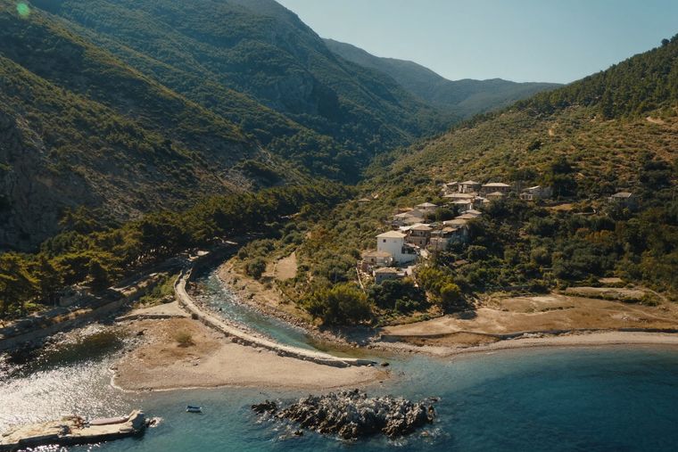
A run of small coves — Bunec, Krorëz and Shpella — below the village of Lukovë.
Subject · Vlorë
The 120 km of Ionian coast between the Llogara pass and Sarandë, where the Ceraunian mountains fall straight into the sea.
Something wrong on this page? Corrections are welcome and are checked against the source record. Tell us what is wrong and, if you can, where the right figure comes from.