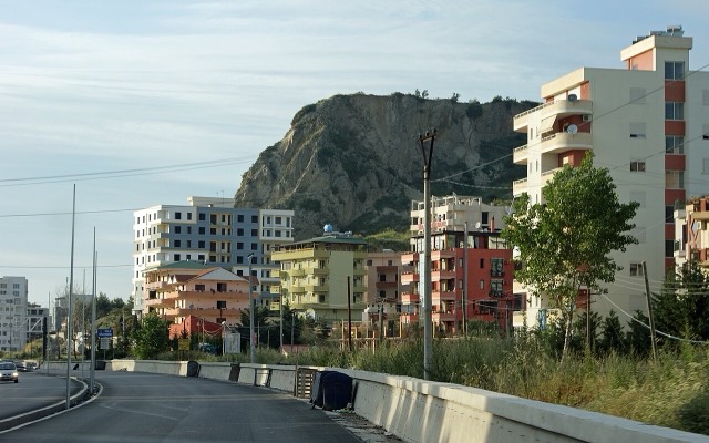
مدينة · Durrës
Durrës
Albania's principal port and its oldest continuously inhabited city, founded as Epidamnos in 627 BC.
كل مقاطعة، كل ساحل، كل قرن
عرض إرشادي
هل أنت جديد على ألبانيا؟ تفتتح كل صفحة بشرح مبسّط يمكن قراءته لطفل في العاشرة من عمره، قبل أن تبدأ التفاصيل.
عرض للمتخصصين
أنت تعرف الأساسيات بالفعل. مباشرةً إلى الجوهر، مع إخفاء الشروح المبسّطة. هذا هو الوضع الافتراضي.
شاطئ · Durrës County
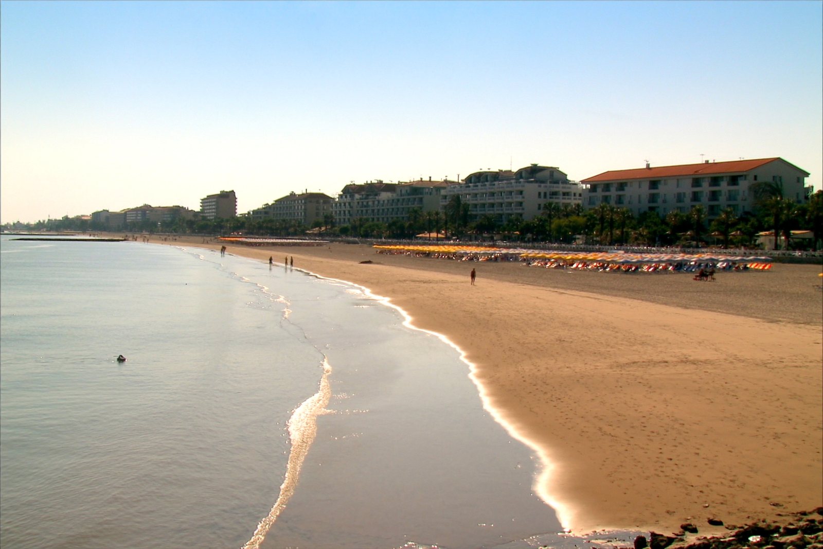
A continuous sand strip running south from the city — the busiest beach in Albania by visitor numbers.
حفظ
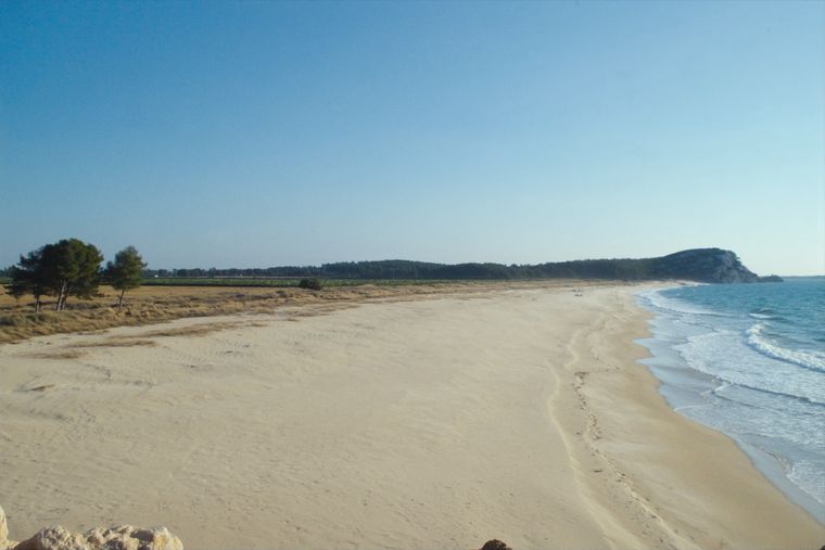
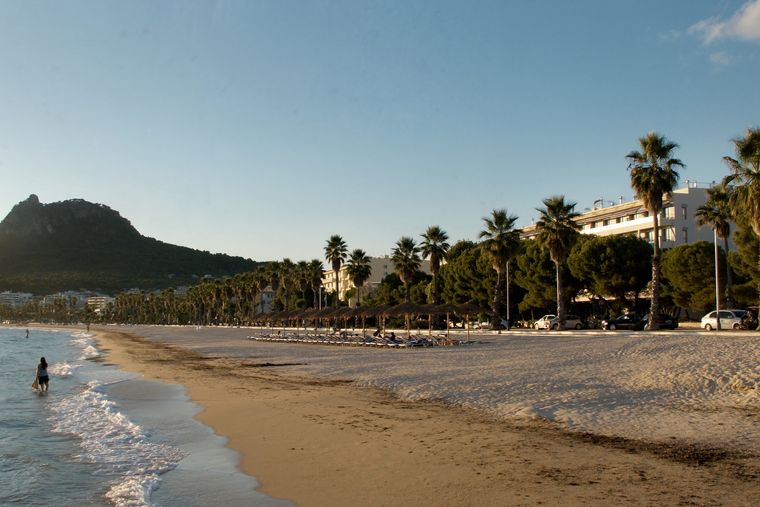
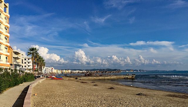
Durrës has a very long sandy beach that runs south from the city. It is the beach most Albanian families go to, and it is very busy in July and August.
Durrës has a very long sandy beach that runs south from the city. It is the beach most Albanian families go to, and it is very busy in July and August.
Durrës Beach extends along the Bay of Durrës, which lies on a flat alluvial plain between the mouths of the Erzen and Ishëm rivers on the Adriatic Sea. The city sits at the southeastern corner of the Adriatic, and the coastline stretches from the Cape of Rodon and the Ishëm river mouth in the north, across the Bay of Lalzi, to the Shkëmbi i Kavajës promontory in the south.
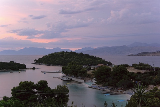
The coast divides broadly into two distinct zones with sharply different characters. The southern stretch around Golem has undergone decades of mass beach tourism and, according to the article, uncontrolled urban development. The northern stretch around Lalzit Bay has remained largely undeveloped and was, as of the time of writing, being developed for resort tourism, with construction of beach resorts under way since 2009.
Durrës itself is the second most populous city in Albania and has been described as the centre of Albanian mass beach tourism. The city's beaches attract both foreign and local visitors. In 2012, new water sanitation systems were being installed to address sea water pollution affecting the coastal zone.
Under the Köppen classification, Durrës falls within the hot-summer Mediterranean climate zone (Csa). The city's climate is shaped by proximity to the Adriatic Sea and by the hills of the Western Lowlands inland. Summers are predominantly hot and dry; winters are relatively mild; spring and autumn are described as broadly stable in temperature and precipitation.
Mean monthly temperatures range from 7.5 °C (45.5 °F) in winter to 23.8 °C (74.8 °F) in summer, with an average annual temperature of 15.9 °C (60.6 °F). The highest recorded temperature was 39 °C (102 °F), measured on 14 August 1957. The lowest recorded temperature was −6.2 °C (20.8 °F), registered on 26 January 1954.
Rainfall is concentrated in the winter months, with summer months receiving significantly less precipitation. Mean annual precipitation ranges between 1,000 mm (39 in) and 1,273 mm (50.1 in).
The city was founded by Greek colonists in 627 BC on the Adriatic coast of the Taulantii, an Illyrian tribe. According to ancient sources, the colonists came from Corinth and Corcyra and, together with the Taulantii, expelled the Liburni who had previously occupied the area. The territory had been inhabited since at least the Eneolithic period, and Illyrian peoples were present from protohistoric times. The Taulantii are estimated to have arrived no later than the 10th century BC.
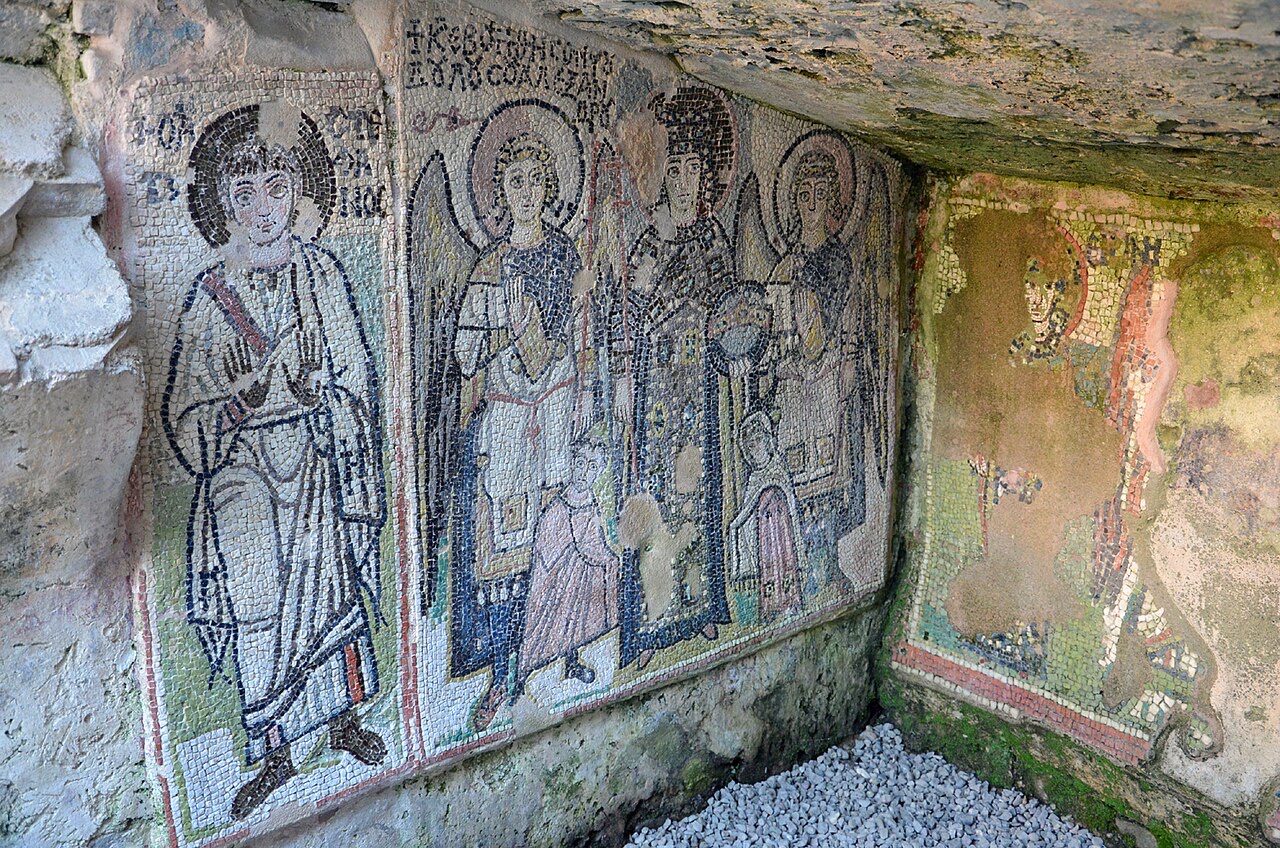
The settlement developed rapidly as a commercial centre. By around the 6th century BC, the citizens of Epidamnos had constructed a Doric-style treasury at Olympia, indicating the city ranked among the wealthiest of the ancient Greek world. Ancient accounts describe it as 'a great power and very populated' city. From around 280 BC, Illyrian kings Monunius and his successor Mytilos minted silver and bronze coins respectively at the city mint, indicating they exercised authority over the city.
After the Roman Republic defeated the Illyrians in 229 BC, the city became a major Roman military and naval base. The Romans renamed it Dyrrachium, considering the older name Epidamnos inauspicious due to its resemblance to the Latin word damnum, meaning loss or harm. Under Roman rule, Dyrrachium became the western terminus of the Via Egnatia, the great road leading east to Thessalonica and Constantinople. The emperor Augustus made it a colony for veterans after the Battle of Actium, granting it the status of a civitas libera (free town).
The Amphitheatre of Durrës is described as the largest amphitheatre in the Balkan Peninsula. It originally had a capacity of 20,000 people. It is a fifth-century construction located close to the city's harbour and is currently included on the Albanian tentative list for designation as a UNESCO World Heritage Site. The annual International Film Summerfest of Durrës, founded in 2008, is held in the amphitheatre in late August or early September.
The Durrës Archaeological Museum, situated near the beach, is the largest archaeological museum in Albania. North of the museum stand sixth-century Byzantine walls, built following the Visigoth siege of 481. The museum's collection focuses on artefacts from the ancient site of Dyrrhachium and spans the Illyrian, ancient Greek, Hellenistic, and Roman periods.
Among the museum's notable holdings are Roman funeral steles, stone sarcophagi, and a colourful elliptical mosaic measuring 17 by 10 feet (5 m × 3 m), known as The Beauty of Durrës. The collection also includes miniature busts of Venus, reflecting a period when Durrës functioned as a centre of worship of the goddess. The Byzantine city wall, also called Durrës Castle, is separately noted as one of the city's principal sights; the emperor Anastasius I rebuilt and strengthened the walls, which reached 12 metres (39 feet) in height and were, according to the Byzantine historian Anna Komnene, thick enough for four horsemen to ride abreast on them.
Ottoman forces took Durrës in 1501 after withstanding a siege by Sultan Mehmed II in 1466. Under Ottoman rule, the city was renamed Dırac and did not prosper during its first two centuries under that administration. Its importance declined sharply and it became, according to the article, a base for piracy. The population remained small: when the Ottoman chronicler Evliya Çelebi visited in 1670–71, he recorded approximately 150 houses and a mosque named after Sultan Bayezid II. Much of the population, including the local kadı, chose to live inland, particularly in the newly established town of Kavajë, 14 km to the south.
Economic recovery began from the late 17th century, driven primarily by the salt mines, which exported salt throughout the Balkan interior. According to the diplomat and Turkologist François Pouqueville, around 1699 approximately 100 Turkish and Greek merchants in the city exported significant quantities of beeswax, finished cloth, fine leather, and grain to Venice annually, despite an official prohibition from Constantinople. France, England, the Netherlands, and Austria all established consulates in Durrës in 1700.
By the mid-19th century the population stood at around 1,000 people in approximately 200 households. Administrative reform during the Tanzimat era established a dedicated Sanjak of Durrës within the İşkodra Vilayet in 1880, which reversed the demographic decline. By 1892–93, the population of the kaza of Durrës had grown to approximately 4,781, comprising 3,018 Muslims, 1,514 Orthodox Christians, 201 Catholics, and 48 foreigners. On 26 November 1912, as the Ottoman Empire was engaged in the First Balkan War, nationalists led by Ismail Qemali raised the Albanian flag over Durrës; Albanian independence was declared two days later, ending over four centuries of Ottoman rule.
The Port of Durrës is located in the southwest of the city and is one of the major ports of the Adriatic Sea. It is situated on an artificial basin formed between two moles, with a west-northwesterly oriented entrance between the ends of those moles. The port handles more than 1.5 million passengers per year and is described as one of the largest passenger ports on the Adriatic Sea.
The port serves as a key node in the Pan-European Corridor VIII, which runs from Durrës on the Adriatic coast to Varna on the Bulgarian Black Sea coast. Daily ferry services connect Durrës to Bari, Italy. The port underwent major upgrades culminating in the opening of a new terminal in July 2012. In 2012, The Globe and Mail ranked Durrës first among eight cruise ports it identified as emerging destinations.
The port's strategic significance has repeatedly shaped the city's modern history. It was the site of the initial Italian landings on 7 April 1939 during the Italian occupation of Albania, and was fiercely defended by Mujo Ulqinaku. During the Second World War, port installations were destroyed by retreating German soldiers in autumn 1944. After the fall of communist rule in 1990, the port became a departure point for mass emigration to Italy, including hijacked vessels; in August 1991 alone, over 20,000 people migrated to Italy by this route. Italy subsequently placed the port area under military control as part of the European Community's Operation Pelican food-aid programme.
أكثر الأشهر دفئاً هو August (متوسط أعلى درجة حرارة يومية 28°C), وأبردها هو January (متوسط أدنى درجة حرارة يومية 6°C), وأكثرها مطراً هو November (171 mm). يبلغ متوسط هطول الأمطار السنوي الإجمالي 1,235 mm. تبلغ حرارة البحر ذروتها في أغسطس عند نحو 26°C.
| الشهر | الأعلى | الأدنى | الأمطار | أيام المطر | ساعات الشمس/اليوم | البحر |
|---|---|---|---|---|---|---|
| January | 11°C | 6°C | 134 mm | 12 | 7.2 h | 16°C |
| February | 12°C | 7°C | 118 mm | 11 | 8.2 h | 14°C |
| March | 14°C | 8°C | 116 mm | 11 | 9.7 h | 15°C |
| April | 17°C | 11°C | 99 mm | 11 | 10.8 h | 16°C |
| May | 21°C | 15°C | 74 mm | 9 | 12.2 h | 19°C |
| June | 25°C | 19°C | 45 mm | 6 | 13.6 h | 24°C |
| July | 28°C | 22°C | 29 mm | 4 | 13.8 h | 26°C |
| August | 28°C | 22°C | 36 mm | 4 | 12.9 h | 26°C |
| September | 25°C | 19°C | 116 mm | 9 | 10.7 h | 24°C |
| October | 21°C | 15°C | 135 mm | 10 | 9.2 h | 23°C |
| November | 17°C | 12°C | 171 mm | 13 | 7.4 h | 19°C |
| December | 13°C | 8°C | 162 mm | 13 | 6.7 h | 17°C |
المصدر: ERA5 reanalysis via Open-Meteo, 1994–2023 · "الأعلى" و"الأدنى" هما متوسط أقصى وأدنى درجة حرارة يومية للهواء. تحسب "أيام المطر" الأيام التي يبلغ فيها الهطول مليمتراً واحداً على الأقل.
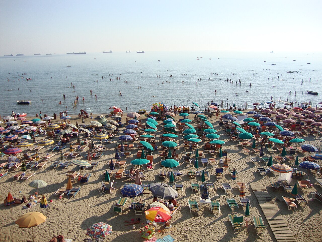
مدينة · Durrës
Albania's principal port and its oldest continuously inhabited city, founded as Epidamnos in 627 BC.
شاطئ · Tiranë
A quieter sand beach south of Kavajë, backed by farmland rather than hotels.
شاطئ · Tiranë
The continuation of the Durrës sand south past Qerret and Mali i Robit.
دليل
Sand in the north and centre, pebble in the south: the single most useful distinction on the coast.
دليل
Sand beaches in the centre and north, short drives, and a culture that is genuinely welcoming to children.
مقارنة
Two coastal cities 120 km apart that solve different problems: Sarandë is the base for the far south, Vlorë is a working city…
مقارنة
Clear pebble coves four hours from the airport, or shallow sand twenty-five minutes from it.
ثمة خطأ في هذه الصفحة؟ نرحب بالتصويبات وتُراجَع في مواجهة سجل المصدر. أخبرنا بما هو خاطئ، وإن أمكن، بالمكان الذي يأتي منه الرقم الصحيح.