Koruma altındaki alan · Vlorë
Llogara National Park
A pine-forested pass at 1,027 m where the road drops from mountain forest to the Ionian in a few kilometres.
Her il, her kıyı, her yüzyıl
Rehberli görünüm
Arnavutluk'a yeni misiniz? Her sayfa, ayrıntılara geçmeden önce on yaşında bir çocuğa okuyabileceğiniz sade bir açıklamayla başlar.
Uzman görünümü
Temel bilgileri zaten biliyorsunuz. Sade açıklamalar gizli, doğrudan özüne geçin. Bu varsayılan ayardır.
Plaj · Vlorë County
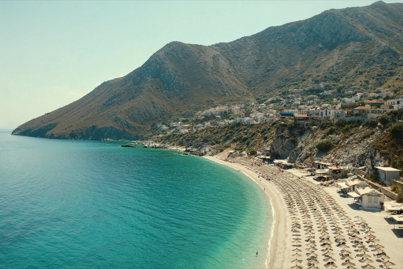
A long white pebble shore under the Ceraunian ridge, and the Riviera's main nightlife strip.
Kaydet
Dhërmi has a long beach of white pebbles with very blue water. It is one of the busiest parts of the Riviera in summer, with beach bars and music.
Dhërmi has a long beach of white pebbles with very blue water. It is one of the busiest parts of the Riviera in summer, with beach bars and music.
Dhërmi Beach lies on the Ionian coast of southern Albania, at the southwestern foot of the Ceraunian Mountains in Vlorë County. The village of Dhërmi, from which the beach takes its name, sits on a mountain slope at approximately 200 metres in altitude, about 42 kilometres south of Vlorë and 69 kilometres north of Sarandë. The mountains descend steeply to the southwest before meeting the coast; the island of Corfu is visible to the south.
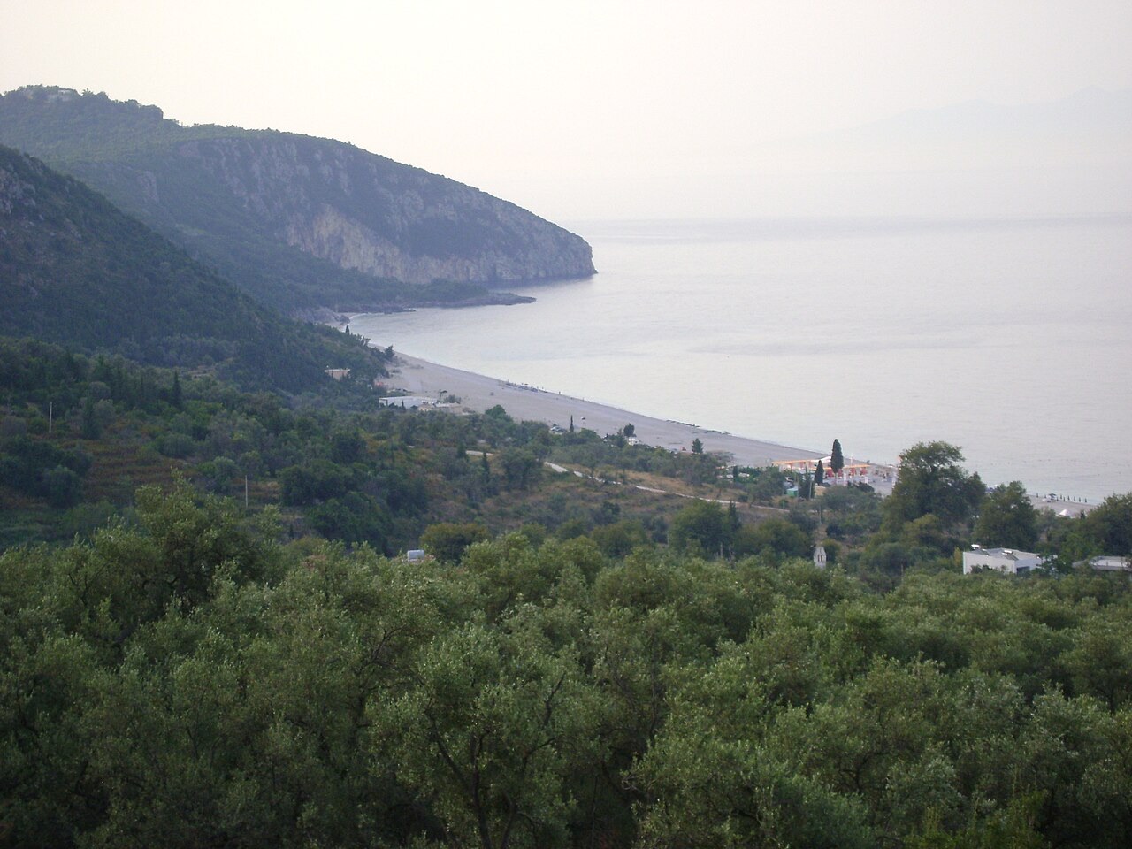
The beach extends for 5 kilometres along the coastline. At its southern end a hill rises, on which the Monastery of Saint Theodore is situated. The nearby village of Palasë lies close to the same stretch of coast. Several landmarks are associated with the broader coastal area, including the Bay of Grama, a pirates' cave, and the harbour of Gjipe.
The settlement is recorded in official Albanian as Dhërmi (definite form: Dhërmiu) and in Greek as Δρυμάδες (Drymádes), sometimes rendered in Latin script as Drimades or Drymades. The Greek name is used primarily by the village's established inhabitants, who speak a local variety of the Greek Himariote dialect. The Albanian name is used mainly by Tosk- and Gheg-speaking newcomers and seasonal workers who arrived from other parts of Albania during the socialist period (1945–1991) or more recently.
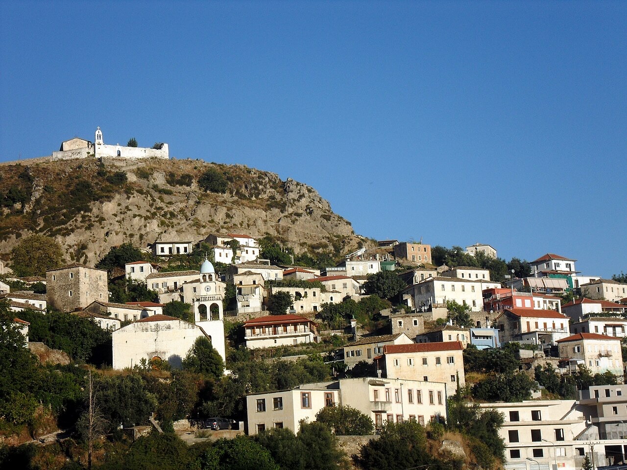
The village comprises four neighbourhoods: Gjilek, Kondraq, Kallami, and Dhërmi proper. Long-standing residents refer to themselves as horiani or Drimadiotes, a term denoting that they are locals who originate from the village itself.
The earliest documented record of the settlement appears in an Ottoman defter of 1583, which registers it as a community in the Sanjak of Delvina with 50 households. The personal names recorded at that time were predominantly from the Albanian onomastic sphere—examples include Leka Gjini, Gjin Kondi, and Gjoka Qezari—alongside names reflecting broader Orthodox Christian tradition, such as Petri Dhima, Nikolla Kosta, and Kristo Dhimo. Albanian historian Kristo Frashëri concluded that none of the recorded names could be classified as ethnic Greek onomastics.
In 1632, Greek Cypriot missionary Neophytos Rodinos founded the first Albanian-language school in Dhërmi. The following year, 1633, Rodinos also established a Greek-language school in the village. By 1682 additional Greek schools were operating with support from the local bishopric of Himara, and at some point during the 17th century—the precise year is not recorded—a further Greek school, the Vizilios School, opened under the sponsorship of a local benefactor. By the 1898–1899 school season, three Greek schools were running: an elementary school, a secondary school, and a girls' school.
In 1693, responding to a request from Himariots to the Pope of Rome, a Basilian mission was sent to Albania. Among its members were Nico Catalano, who held the title of Archbishop of Durrës, and Basilian monk Filoteo Zassi, from the Arbëreshë town of Mezzojuso. The mission departed at the end of January 1693 and made Dhërmi its first stop. Catalano opened a school in the Himarë region, based in Dhërmi, where more than eighty students—both Christian and Muslim—enrolled from surrounding villages. He taught Christian doctrine, farming techniques, and other practical skills, and conducted his teaching and preaching in Albanian, which he regarded as the most effective means of countering the spread of Islam.
Catalano later fell ill in the nearby village of Vuno and died on 3 June 1694. He was buried at the Church of St. Athanasius in Dhërmi. The mission ultimately failed: Italian missionary Giuseppe Schirò wrote in 1722 that Dhërmi was inhabited by Greeks, and the Catholic initiative produced no lasting result, as local interest and student recruitment had been insufficient.
On 5 November 1912, when the nearby town of Himara came under the control of Greek forces led by local major Spyros Spyromilios, armed groups from Dhërmi declared their readiness to support the movement for incorporating the rest of the region into Greece.
The Church of St. Athanasius in Dhërmi has been demolished twice by state authorities. The first demolition occurred during the era of the People's Republic of Albania. After the restoration of democracy in 1991, the local Orthodox Church rebuilt the structure.
In 2015 the church was demolished a second time by Albanian state authorities. The event provoked a dispute between the Albanian Orthodox Church and the Albanian Government, and created tensions between the municipality of Himarë and both the local Albanian and ethnic Greek Orthodox communities. By 2018 the church was undergoing reconstruction.
The established population of Dhërmi is an ethnic Greek community. Residents speak a variety of the Greek Himariote dialect, which is characterised by archaic features not retained in Standard Modern Greek, and partly the Tosk Albanian dialect. There are also Tosk-speaking and Gheg-speaking newcomers and seasonal workers who relocated to Dhërmi from other parts of Albania during the communist era (1945–1990).
The coastal area has experienced a significant boom in construction of accommodation facilities in recent decades, including wooden villa complexes, reflecting a marked increase in seasonal population alongside the settled community.
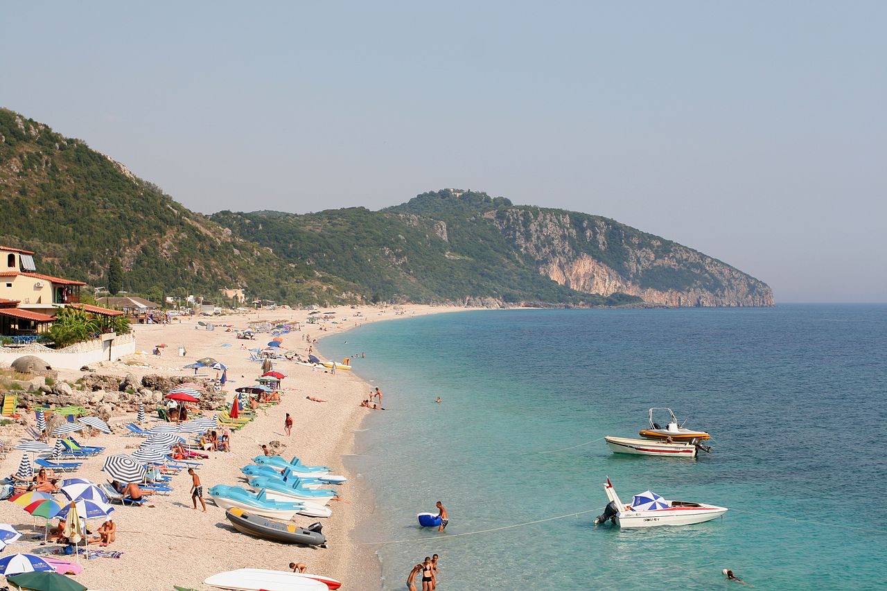
Dhërmi Beach is 5 kilometres long and is considered one of the principal attractions of Albania's Ionian coast. The area is known both for its beach and for a nightclub-based nightlife concentrated in the modern resorts along the coastline. In 2018 the Albanian Ministry of Tourism and Environment designated Dhërmi as a centre of the Albanian Riviera.
Several recurring festivals are held in or near Dhërmi. The government promotes the 'Kala Fest' festival to support tourism in the area. The Himarë region, including Dhërmi, has a particular association with beekeeping and honey production; a three-day fair called 'Mjalt Fest' takes place annually. Former minister Blendi Klosi launched a campaign called 'Smile Albania' to promote local Albanian cuisine as part of a broader touristic offer under the slogan 'Local products, an added offer in our touristic package'.
Religious and historical sites in the immediate vicinity include the Hypapante Church, the Panagia Monastery Church, St. Stephen's Church, and the Monastery of Saint Theodore at the hill marking the southern end of the beach. The Bay of Grama, a pirates' cave, and the harbour of Gjipe are also listed as local landmarks.
En sıcak ay August (günlük azami sıcaklık ortalaması 30°C), en soğuk ay ise January (günlük asgari sıcaklık ortalaması 6°C), ve en yağışlı ay November (255 mm). Yıllık toplam yağış ortalaması 1,652 mm. Deniz suyu sıcaklığı Ağustos'ta yaklaşık 26°C.
| Ay | Azami | Asgari | Yağış | Yağışlı gün | Güneş/gün | Deniz |
|---|---|---|---|---|---|---|
| January | 12°C | 6°C | 190 mm | 13 | 7.1 h | 17°C |
| February | 12°C | 6°C | 163 mm | 12 | 8.0 h | 15°C |
| March | 14°C | 8°C | 156 mm | 13 | 9.5 h | 15°C |
| April | 18°C | 10°C | 117 mm | 14 | 10.8 h | 16°C |
| May | 22°C | 15°C | 93 mm | 12 | 12.1 h | 19°C |
| June | 26°C | 19°C | 59 mm | 8 | 13.6 h | 24°C |
| July | 29°C | 22°C | 30 mm | 6 | 13.8 h | 26°C |
| August | 30°C | 22°C | 39 mm | 6 | 12.9 h | 26°C |
| September | 25°C | 18°C | 138 mm | 11 | 10.7 h | 26°C |
| October | 21°C | 15°C | 173 mm | 11 | 9.2 h | 25°C |
| November | 17°C | 11°C | 255 mm | 14 | 7.1 h | 21°C |
| December | 13°C | 8°C | 238 mm | 14 | 6.5 h | 18°C |
Kaynak: ERA5 reanalysis via Open-Meteo, 1994–2023 · "Azami" ve "Asgari", günlük ortalama maksimum ve minimum hava sıcaklıklarıdır. "Yağışlı gün", en az 1 mm yağış düşen günlerin sayısını ifade eder.
Koruma altındaki alan · Vlorë
A pine-forested pass at 1,027 m where the road drops from mountain forest to the Ionian in a few kilometres.
Plaj · Vlorë
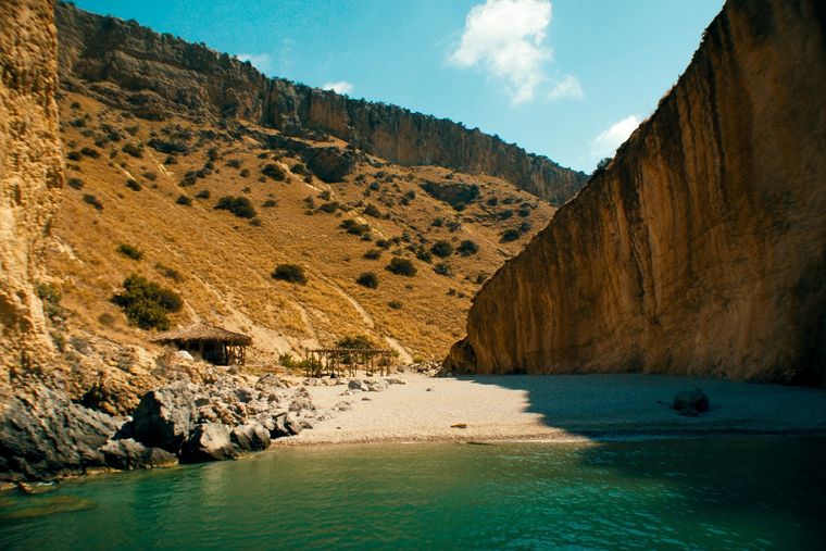
A pebble beach at the mouth of a limestone canyon, reachable only on foot or by boat.
Plaj · Vlorë
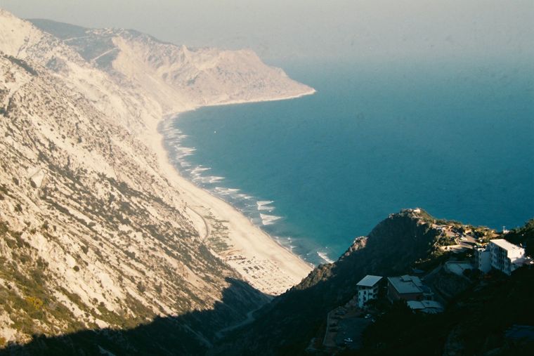
The first Riviera beach south of the Llogara pass, below the road's most dramatic descent.
Plaj · Vlorë
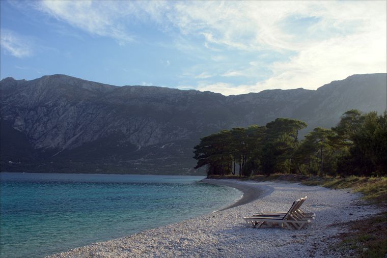
The pine-backed northern half of the Dhërmi bay, slightly quieter than the main strip.
Konu · Vlorë
The 120 km of Ionian coast between the Llogara pass and Sarandë, where the Ceraunian mountains fall straight into the sea.
Köy · Vlorë
An old white village on the slope above one of the Riviera's longest pebble beaches.
Bu sayfada bir hata mı var? Düzeltmeler memnuniyetle karşılanır ve kaynak kayıtla karşılaştırılarak kontrol edilir. Neyin yanlış olduğunu ve mümkünse doğru rakamın kaynağını bize bildirin.